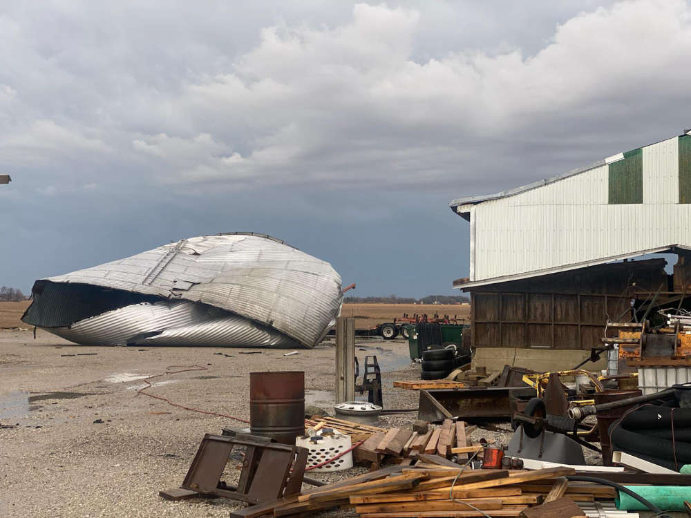
Many community members are ending the week cleaning up debris and damage after two major storms ravaged northern Indiana with high winds, hail and torrential rain.
For people like Stephen Berggren, deputy director of the Fulton County Emergency Management Agency, whose teams' key role this week was to help report storm damage in the area, it's been nothing short of eventful.
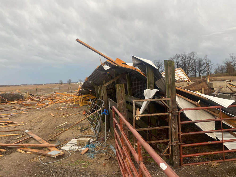
Damage on a barn west of Kewanna Sunday, March 31. Photo taken by WROI GIANT fm reporter Shelby Lopez.
On Sunday, March 31, a storm created its own personal obstacle for the Fulton County EMA team when a 35-foot radio tower that once stood behind the EMA office at 1728 E. State Road 14, fell to the ground. The tower played a vital role in sending communication to those outside of the county, particularly in times of severe weather, disasters and other emergencies that may cause the area to lose internet or cellphone service.
Although Berggren can't give a definite answer if or when the tower will be replaced, he says he is thankful to have several EMA volunteers on their crew who are also radio club members capable of broadcasting damage reports from their home equipment for future emergencies.
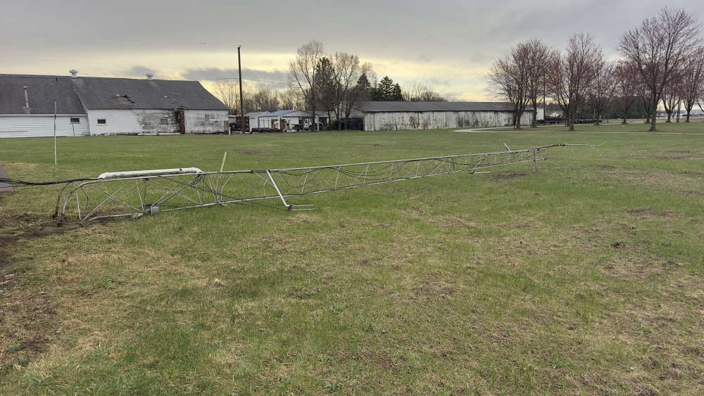
Photo of Fulton County EMA tower on the ground Wednesday. Photo taken by Stephen Berggren.
Straight line winds of 60 to nearly 80 mph whipping through the area Sunday resulted in numerous reports of downed trees, branches and power lines. Structural damage to homes, barns and businesses occurred in locations that saw the strongest winds, with roofs being blown off or seriously damaged, buildings or barns collapsing and shingles or siding torn off houses.
Berggren wanted to remind community members that despite many people thinking they can depend on hearing sirens to know when to take shelter during severe weather, the sirens are intended for citizens outdoors only.
"The safest way to stay on top of severe weather and keep your family safe is by keeping updated with a weather radio, weather app, or local news before it becomes an emergency," Berggren said.
The first wave of storm surveys were conducted in the area from March 31 until April 1.
By 11 a.m. April 1, three tornadoes were confirmed for Indiana, the first EF-1 tornado starting in Starke and Marshall counties, catching peak winds of 110 mph. Hail up to one inch in diameter or less was reported with the storms.
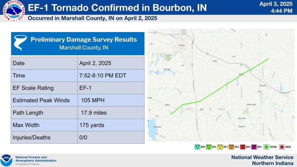
On Wednesday, April 2, storms once again returned, giving Marshall County another beat down after it was yet again ripped by another EF-1 tornado, heavily impacting Argos and Bourbon.
According to NWS investigators, the path for Wednesday's tornado traveled nearly 18 miles long, and got up to 175 yards wide, eventually ending in Kosciusko County. Winds peaked at around 105 mph.
A press conference was held by Marshall County Emergency Management Thursday morning to discuss cleanup efforts in Bourbon, and officials say Indiana 211 has been activated for Marshall County.
Those who experienced damage are encouraged to call 211 or visit 211's website to make a report, which helps officials more easily find, record and start recovery efforts. The damage reports collected could potentially help Marshall County reach disaster threshold, which would initiate additional financial assistance for property owners.


 Missing Silver Lake teen found safe
 Indiana State Parks hiring for lifeguards at public pools and beaches
 IDVA offers grant opportunities for non-profit organizations serving the Indiana Veteran Community
 Town of Culver hiring for street dept, clerk-treasurer's office
 Bookings and Blotter – April 3, 2025
 Mother of missing Silver Lake teen pleads with public to help find daughter
 Rochester man accused of beating dog to death


