

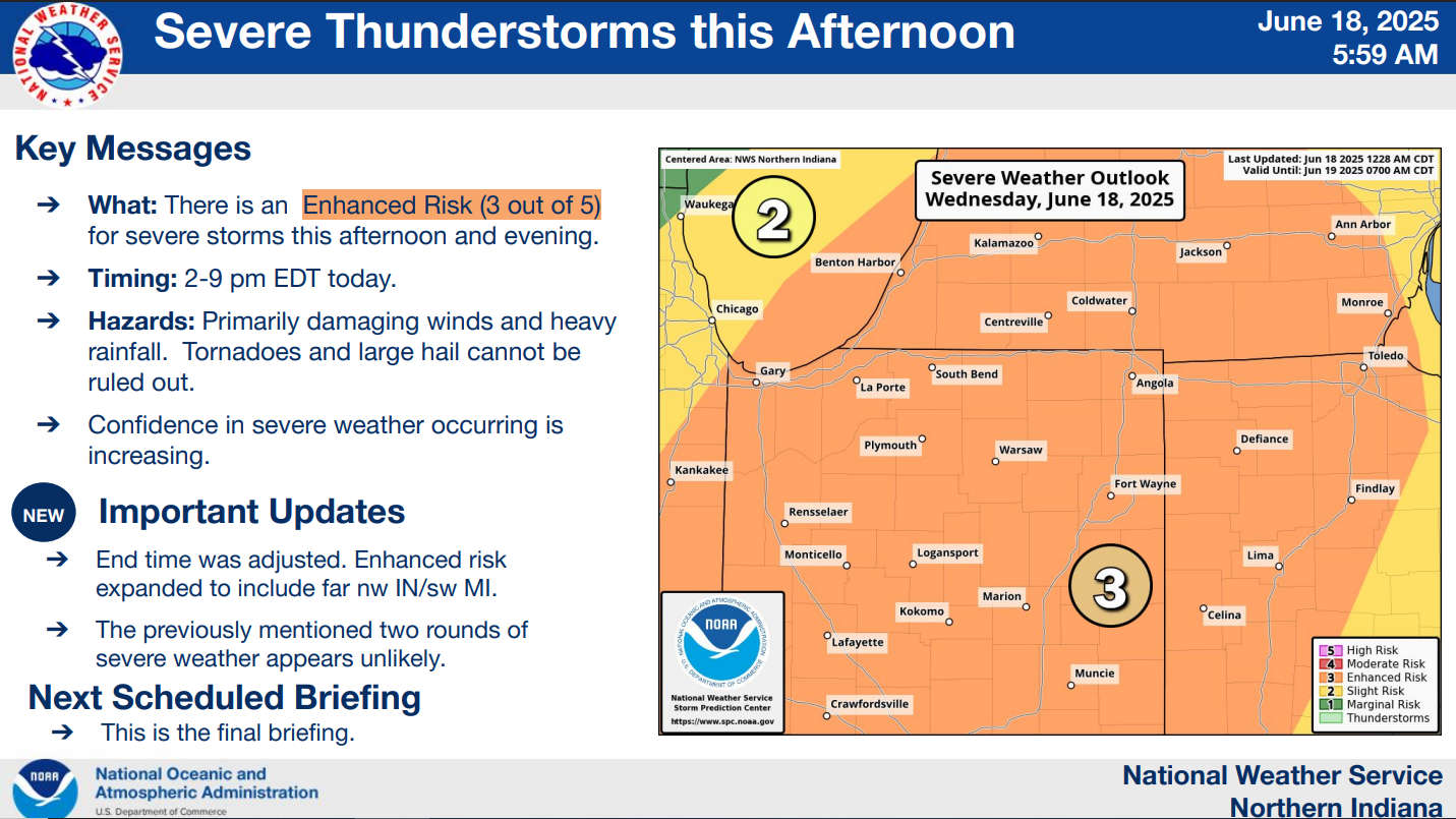
The National Weather Service for Northern Indiana has placed Marshall County in the "Enhanced Risk," which is a level 3 of 5, for severe storms this afternoon and evening.
Confidence is increasing that a line of severe thunderstorms will pass through Marshall County between 2 pm and 7 pm today.
This morning's line of storms is NOT an early arrival of the severe line.
Damaging winds, heavy rainfall, and, to a lesser extent, tornadoes and large hail are the primary threats in this afternoon and evening's scenarios. Storms will produce heavy rainfall rates of 1 to 2 inches per hour.
 Michiana Hematology Oncology to end infusion services in Plymouth
 Commissioners & Council to meet with legislators in joint meeting Monday
 Bremen man arrested by county police for invasion of privacy and domestic battery
 M.C. Sheriff recognizes two dispatchers
 Governor Braun holds ceremonial signing for historic health care solutions
 Indiana DNR plans aerial treatment in Starke County next week to slow spread of spongy moths
 Redevelopment Commission hears plans for rebranding, reorganizing Aquatic Center
 Audition space still available for Missoula Children's Theater at the REES